Weather tracker: Warm Yellow Sea strengthens storms in South Korea

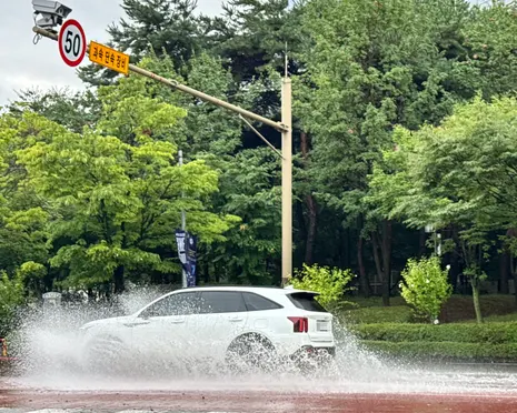
Table of Contents
Warming Seas and Record Heat: A Global Weather Frontline in Late August
Wanderstayfinder.com – Unusually warm waters in the Yellow Sea are supercharging thunderstorm systems now battering South Korea’s western coastline, while simultaneously, Europe braces for another stretch of extreme heat as its record-shattering meteorological summer grinds toward its final days. Across three continents, the same underlying signal — oceans and atmospheres running well above their historical norms — is producing weather events that strain infrastructure, trigger emergency declarations, and push temperatures toward all-time benchmarks.
South Korea: Preparedness Under Pressure
Prime Minister Han Seong-sook convened senior government officials this week to coordinate the national response to an incoming wave of intense rainfall. Forecasts indicate that cumulative totals across central and northern provinces could surpass 200 mm in localized pockets, a threshold that historically triggers flash flooding, landslides on steep terrain, and disruption to rail and road networks. The urgency of the briefing is underscored by the fact that South Korea already endured a severe rainfall episode earlier in August, leaving several regions with saturated soils and compromised drainage capacity.
The immediate threat arrives in the form of organized thunderstorm clusters that formed over the western Yellow Sea and are tracking eastward toward the Korean peninsula. Disruption is anticipated through Monday, with the systems gradually weakening and shifting offshore by Tuesday. The timing places peak rainfall during working hours, complicating evacuation logistics and increasing the likelihood of localized transport shutdowns.
The Yellow Sea Factor
The storms’ intensity is directly linked to the sea surface temperature beneath them. The Yellow Sea currently sits at approximately 29 °C — roughly 4 °C above the climatological mean for this period. Warmer sea surfaces inject greater latent heat into the lower atmosphere, deepening convection and allowing thunderstorms to sustain themselves longer than typical late-August systems. This anomaly effectively extends the window of severe-weather risk beyond what seasonal averages would suggest, giving meteorologists and civil-defense planners a narrower margin for error.
Thailand and the Philippines: Monsoon and Calamity
Further south, Thailand has issued warnings for heavy to very heavy rain as the country navigates the midpoint of its southwest monsoon season, which spans May through October. Peak-season rainfall of this magnitude can overwhelm urban drainage in Bangkok and trigger rapid riverine flooding in the central plains.
In the Philippines, the province of Tarlac has been formally placed under a state of calamity following prolonged, intense rainfall throughout August. Such a declaration unlocks national disaster-fund allocations and authorizes emergency reconstruction spending, signaling that the accumulated damage has exceeded the province’s own capacity to respond.
Pacific Tropical Activity
The north Pacific basin has been exceptionally active this season, and that pattern is set to continue through the coming week. Last week saw Typhoon Bang-lang and Tropical Storm Etau form in close proximity in the north-west Pacific. Both systems tracked northward without making landfall, but their near-simultaneous existence illustrates how a single basin can sustain multiple organized circulations at once.
Two additional disturbances near the Philippines and southern China currently carry a medium-to-high probability of organizing into tropical cyclones. The critical threshold for that transition is sustained wind speeds of 39 mph (63 km/h). Should either system cross that bar, forecast tracks will need to be updated within 24–48 hours, with implications for coastal shipping lanes and island-arc communities.
Eastern Pacific: Hurricanes Bearing on Hawaii
On the opposite side of the Pacific, Hurricane Karina — now a Category 1 storm — is forecast to track just north of the Hawaiian chain without making landfall. Tropical Storm Lowell, meanwhile, is expected to intensify into a hurricane by Tuesday before passing south of the islands. Although neither system threatens direct impact, their proximity can enhance trade winds, produce elevated surf along exposed coastlines, and generate heavy rain bands that affect windward slopes.
Europe: The Summer That Would Not End
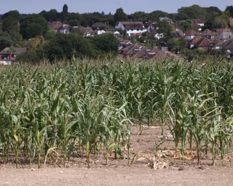
As the meteorological summer (June–August) reaches its close, the heat that defined the season shows no inclination to retreat. Central and southern Europe face another intensification later this week, with temperatures projected to climb approximately 10 °C above the climatological average for the period. Such departures are associated with increased wildfire risk, agricultural stress, and elevated mortality among vulnerable populations.
In Bosnia and Herzegovina, weekend forecasts point toward readings near 40 °C — a figure that would fall just short of the nation’s all-time maximum of 43.1 °C, recorded in 2007. The proximity to that benchmark underscores how consistently the region’s thermal extremes have been ratcheting upward over recent decades, compressing the gap between seasonal peaks and historical records.
The convergence of anomalously warm ocean surfaces, prolonged monsoon-season rainfall, and a European heat dome persisting into September marks a pattern that forecasters increasingly associate with a climate system operating outside its twentieth-century envelope.
For residents in affected regions, the practical guidance remains straightforward: monitor official meteorological bulletins, avoid low-lying areas during peak rainfall hours, secure loose outdoor objects ahead of gusty thunderstorm passages, and hydrate regularly during heat events. The scale of this week’s simultaneous threats — spanning East Asia, the Pacific basin, and continental Europe — makes coordinated, region-specific preparedness more critical than usual.
Related Reading
Frequently Asked Questions
What is Weather tracker?
Weather tracker is the main topic of this guide. The article explains the context, practical details, and next steps readers should understand.
Why does Weather tracker matter?
Weather tracker matters because readers are looking for a useful answer, not just a short summary. Good content should match search intent and help them decide what to do next.